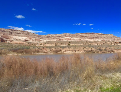
We were on our return trip to Moab from a drive up Scenic Highway 128, along the Colorado River, where we'd camped next to Dewey Bridge the previous night. As evening settled in we took a trail to "the top of the world" but fell short of our destination -- a ten mile, one-way, hike. Nevertheless, we felt like it was just us, the cows and a couple of boondockers way up over the Colorado River Valley.
Suddenly, a morning inspiration and a detour onto highway 96 to Castle Valley became our new destination. Castle Valley turned out to be just that -- a valley of assorted summer homes with no town other than a cluster of mailboxes along with a kiosk of town notices. High up a narrow twisting road, Higway 96 turned into 73 and then 127 as it looped back around to Moab. What a treat! We stopped to play in the snow; to gasp in delight at the views; and to congratulate ourselves that we'd taken this amazingly beautiful side-trip-of-chance.
The map Ed and I were using was left over from a road trip to Utah Brad and I took a number of years ago. The map had two curious penned-in circles on it. One circled "Warner" and the other "Geyser Pass". Our route up to Castle Valley and then up, up and up through these beautiful mountains brought us to these circled areas.
The reason for the trip to Utah Brad and I took all those years ago was for Brad to attend Holt's wedding. During the wedding celebration itself I was camped along the Colorado River where there are eleven small campgrounds along this scenic highway 128 route. While there I spent time alone riding slick rock trails near Moab. I also drove through Arches National Park, and explored other parts of this beautiful area while Brad was several-days-wedding-occupied. My memories are vague, so finding the circles on our map was enticing. Who circled them? Why? The logical explanation for the circles was Brad marking Holt's wedding celebration bike route. Ed and I felt like we were retracing a romantic wedding event. We were left with warm feelings for both Brad and Holt, and their friendship dating back to University of Colorado graduate school days, as we sleuthed out this mystery of the circles-on-the-map.
Returning to Moab we went out for lunch, followed by coffee, as we lingered in the sunshine and the Saturday afternoon festivities in this lively town of outdoor adventure. Watching the equipment pass by is quite the all-day parade. An unending barrage of unimaginable and weird off road vehicles as well as automobiles and vans and pickups hauling kayaks, bicycles, and rafts, plus campers of every make and combination from handmade funky curiosities to fancy European rigs. Every imaginable machine passed by, from huge to tiny and every size in between. They sported solar panels and gear carrying devices of amazing creativity. If you're not hiking, biking, off-roading, kayaking or doing some other extreme sport in Moab you are definitely not with the program!! This is not the town for physical inactivity.
Tonight we are boondocked off Highway 313, the road to Canyonlands and Island in the Sky. All campgrounds were filled by the time we left the Moab parade to seek out a campground. Our off road camp is a cow pasture and an ATV paradise. Each group camped here has vehicles -- big, small and everything in between -- for each family member to spend the day riding these dirty, dusty, rough backroads.
Fortunately, the roar of engines stopped at dinner time, not to resume again for the evening. Entertainment became campfire quiet and this machine-noisy-camp-by-day became a mulled music of voices and crackling fires as the sun set.
~~~
"But neither money nor machines can create. They shuttle tokens of energy, but they do not transform. A civilization based on them puts people out of touch with their creative powers."
~ Lewis Hyde, Alcohol and Poetry: John Berryman and the Booze Talking


No comments:
Post a Comment
garden@whidbey.com