Showing posts with label Maps. Show all posts

Tuesday, February 12, 2019

Pioneertown

Driving back to Palm Desert, after our wonderful week in Ojai, we took every back road we could find to avoid the freeway.  As the day began to turn to night, we started our search for a place to camp.
Pioneertown showed up on our map with a little tent, so we headed for it.  By the time we finally saw the Pioneertown sign it was quite dark. We couldn’t quite figure out where the campground was located and once we determined its location, we couldn’t find the road to get to it.  The few lights marking the town were mostly blinding or for “mood” only and did a poor job of lighting our way.  Once found, we discovered the campground was a parking lot.  Outhouses and a scattering of picnic tables were the only amenities.  The price, $10.00 per person.    For one person, quite the bargain.  $20 for two not too bad so we stayed.  I’m so glad we didn’t drive in with three kids.  Fifty dollars would have sent us out into the desert for boondocking, pronto.  

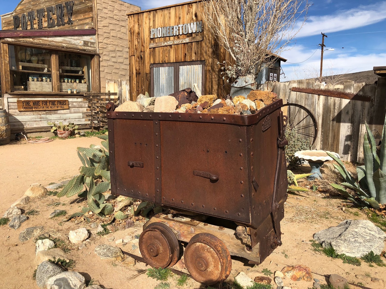
The next morning we went out exploring.  Pioneertown is indeed cute and we thoroughly enjoyed wandering around.  Nothing was open, but because the buildings
are also residential, it didn’t feel deserted.  Also, while we were there two commercials were being filmed.  One was a dance group of about 20 dancers.  The other consisted of about half a dozen motorcycle cops.  But, back to Pioneertown.  It consists of one street, called Mane Street.  Roy Rogers cut the town ribbon back in 1946, when it was first opened.  After several years of fame and success, Pioneertown hit some rough spots, turning into a place for the down and out.  These days it is enjoying a bit of a revival, with lots of visitors and care being poured into the buildings, together with serving as a backdrop for commercials and films again.

This first photo is of the Post Office, in operation since 1946, and still serving the community.


Nearby is Pappy and Harriet’s, and on the Sunday night we were there, it was packed.  Inquiring about dinner we were told “no way”.  The restaurant was part of the original Pioneertown, but Pappy and Harriet did not own it until 1982 and continued until Pappy’s death.  The new owners must be carrying on in Pappy’s fine tradition concluded  from the crowd we saw.


And, there’s nothing like horses clomping down the street to make the scene perfect.


~~~

Until we meet again, may the good Lord take a liking to you.

Roy Rogers 


Friday, October 14, 2016

Closed for the Season

Closed signs greet us everywhere. So far we're spent four nights camping in four closed campgrounds. No services but free. We're thinking this is classy boondocking.

Campgrounds are not alone in being "closed for the winter". Many small restaurants and food stands report they'll see us again in the spring. Motels, B&B's, boat rentals, and private RV parks are also sporting closed signs along with gated entries and shuttered windows. Even the zip line we passed was closed for the season.

Despite all the closures we are enjoying our off-season travel. We like the weathering drama and the empty camp grounds plus with so few people are out and about we can scofflaw a bit and let Benton run free. And on clear nights it is free of lights, giving us complete night sky dark for star and moon gazing.

Last night there was no star gazing. It was raining when we arrived in camp, raining when we went to bed, rained all night and is still raining this morning. We have one very wet dog! And, if the weather forecast is to be believed, it will continue to rain for several more days.

Nelson, a sweet little town, was on our route yesterday. The typical town sprawl was nicely contained with a river on one side and a mountain on the other.

The courthouse and museum were particularly charming...


Leaving town we crossed this lovely bridge...


Kokanee Creek Provincial Park, our closed, but not, home for the night...


The next morning we backtracked to Nelson for coffee and then continued along Highway 3, crossing Kootenay Bay on a too-cute-for-words free ferry...


This highway is a crazy squiggle running east-west but along the way heads north, then south, then north, and then south again before we leave it and return to the US...


Moyie Lake Provincial Park becomes our day's destination and provides us with a rainy larch-surround home for the night...


Ahead of us is another full day and night in BC before heading for Whitefish. Our departure from home was way too late in the season to head further north on this trip.


~~~

“I would rather sit on a pumpkin, and have it all to myself, than be crowded on a velvet cushion.”

~ Henry David Thoreau

Saturday, September 24, 2016

Trip Delay


This isn't the first time trip delay has happened, in fact, it happened on our first Thistle Adventure too.  Yep, Mr. Ed was not blessed with good teeth.   His teeth want to die before he does so his non-travel days are filled with fillings and extractions and impressions and implants and dentures and bridges and huge outlays of cash.  The dental work, planned to be wrapped up in September, has slid into October. Our Rocky Mountains trip from Alberta to Colorado has shrunk to something much less ambitious because we're getting a late start and the snow is already flying in Banff.  We now have a departure date, God willling and the creek don't rise of October 8, with Ed wrapping up his dental commitments for this fall on the 7th.  

My teeth seem to be doing fine.  Other parts of my aging body, however, are acting up.  Having managed to put the digestive tract health issue behind me, I've now been diagnosed with osteoporosis.  As they say, we don't get out of this life alive, but wouldn't it be lovely if loosing our teeth and doubling over with bad posture didn't need to be part of the game plan.  I could forgo the wrinkles too.


Aah well, complaining won't help my bones, exercise will.  My wrinkles?  I think I'll find some relief with candlelight and no mirrors.  For the osteoporosis I now have my list of stretches and twists and balancing acts along with high impact exercises.  I've biked for years to avoid high impact exercise because of my fused ankle.  High impact exercise is now on the top of the list of what I'm supposed to do -- running, jumping rope, hiking, dancing.  Yikes.  Do I sacrifice the ankle for a straight back?  It feels like a "between a rock and a hard spot" kind of dilemma.

Examining my life, even the struggle parts, I am always able to find gratitude -- wonderful family and friends; beautiful home and community; years and years of high energy and good health; happy childhood; meaningful and stimulating work and leisure activities; and money enough to consider myself rich by world standards.  I'm even grateful to discover there is a payoff to being older bringing with it a sense of maturity I never imagined possible.  Our retirement years, or as I recently read and prefer, our "refire" years, can be full and rewarding!  Long held relationships grow even richer and there is free time to spend as we desire.  A contented feeling, like surround sound drowns out not all, but much of my younger life's anxiety.  And then there's patience.  I have much less for stupid stuff, but much more for a delay or postponement here and there.

So, with a bit of a late start on our fall trip, soon we'll depart.  Reduced in scope yes, but no matter, we definitely are looking forward to another Thistle Adventure.  We'll spend time in the North Cascades, head east to Glacier Park, and then backtrack to Idaho's panhandle.  To explore the panhandle we will drive south on Highway 95, searching for bike trails and sweet small towns, basking in Idaho's scenic beauty.  Fall colors are in our hope-to-see plans too.


One trail we'll seek out is the Pend d'Oreille Bay Trail off Highway 200 (referred to as Idaho's Highway 66).  Highway 200 begins at a junction with Highway 95 in Ponderay, just north of Sandpoint.  A short sweet trail that has Benton wiggling with anticipation.

                                 Image result for Pend d'Oreille Bay Trail
                                  

Our plan is to get far enough south before too much mountain snow and then home before it snows here on Whidbey.  We'll be home for the holidays. "Let it snow!  Let it snow!  Let it snow!"

Early January our first 2017 Thistle Adventure will begin.  Branching out from our southwest travels of these past two years, we currently have two destination bike trails in our sights.  First is the Natchez Trace Parkway, 444 miles from Natchez, Mississippi to Nashville, Tennessee.  The second is the 200 mile Katy Trail State Park in Missouri, along the Missouri River.  But before the trails, we're looking forward to meeting up with Ed's brother and his wife at Big Bend National Park in Texas.


~~~

"When I reflect upon my life, the best things were like a fine wine.  It took more time than I wanted but how glorious the taste when it had matured."

~ Ron Sims

Monday, June 13, 2016

Mapping Our Adventure

Our first go-to-tool when we're planning a trip is a map.  A new adventure's enjoyment and inspiration begins with a map spread out on the table in front of us.  We stare at it, plotting our course, and reveling in the options.  Just like Brad is doing below…


Looking at a globe or Google Earth can take one on a magnificant adventure as well.  So it's with shear joy that I vicariously share Brad and Yessi's summer mapping adventures.  This year, as well as last, they are mapping in the Wallowa Mountains in Eastern Oregon.  But they've also mapped in the Olympics and Cascades in Washington and Big Sur in California.


It's a summer working vacation for them.   They hike for Green Trails Maps, confirming trail accuracy by noting amenities like restrooms, water availability and camping sites, as well as  tracking trail problems.  Floods, wildfires, wind-fall or even too little trail maintenance can alter a trail's course or make it no longer viable.  


Green Trails has this to say on their website:
"Get ready for some epic backpacking!  Our GPS crews are on the trails getting the very latest data and trail conditions for our new map of one of the seven wonders of Oregon."

Yessi & Brad, Green Trails Maps GPS crew


This past spring when we were in Idaho traveling on 209 North we were forced to turn around on a road closed by wind-fall.  As we backtracked Yessi and Brad's trail verification work came to mind.  Clearly the 2015 Idaho map we had recently purchased from Delorme Atlas and Gazatteer had not been checked for accuracy.  A fact that could have been quickly accomplished with a single phone call.  And given the road had been out of commission for a number of years, it was an inexcusable mistake.  This is, after all, why we turn to maps for route finding and why Green Trails Maps is so dedicated to checking their maps for accuracy.

Speaking of maps, a friend just brought to my attention a site called myscenicdrives.com.   The usual mapping apps define the best route as the shortest or fastest but this site puts those criteria aside and goes for scenic.  Windows, BlackBerry, i-phones and Androids are all able to use this free service.  Just enter a zip code or city and state and up pop scenic roads.   This is the data I got  for Whidbey Island.   You can also find hundreds of hiking trails.  The site looks promising and no doubt will become part of our planning repertoire. 

There is also a free travel app to make your travels more educational called History Here.  I have not tried it yet but intend to do so soon.   It is offered by the History Channel, alerting you via your i-phone or Android, about nearby places of interest.   Or a couple of not-for-free apps to try are Roadside America, featuring off-beat tourist attractions or Roadside Presidents, providing birthplaces, grave locations and other related data or points of interest about U.S. presidents.

And a map for seeing where we've been is fun too.  This map is on the back cabinet doors in Thistle.  The red dots mark where we've traveled in the U.S. the past couple of years.


~~~

"Anytime I feel lost, I pull out a map and stare.  I stare until I have reminded myself that life is a giant adventure, so much to do, to see."

~Angelina Jolie


Thursday, May 5, 2016

Boondocking Paradise

After finishing the Trail of the Coeur d'Alene ride and wanting no part of big highways, noise or speed, we selected Idaho 209 north, to connect with Highway 20 and our intended route for crossing Washington. On our map 209 is referred to as a "Major Connector". Despite the major connector designation, this pleasant little road, following the Little North Fork of the Coeur d'Alene River, soon turned to gravel. Ok, we're good with gravel.


Then we encountered winter slides and downed trees with only space enough to allow one-way passage.


Ok, we're still good. Our destination campground had been hit with downed trees leveling signs, tables and completely blocking the entry. We shrug our shoulders and continue on. Ed and I love exploring like this so are unfazed.

A few more miles and we find our camp site. Benton shows his approval by running around like a mad dog...


After all the bumps and hurdles along the way, it's boondocking paradise we've found...


The next morning, after leaving our boondocking paradise, we continue on, on 209. As we drive the road gets narrower and narrower and the downed trees more and more frequent. Then 209 suddenly ended in a complete clusterfuck of wind fall. Not being of the mind to give up, we detour onto forest service road 385. Another road barrier suddenly presented itself -- snow -- but we persisted. Finally, up ahead was a Forest Service truck and a man wielding a chainsaw. Ha, information about road conditions at last.


Ken, with a sweet smile, said, "No way through up ahead. I have a 4-wheel drive and barely made it through the snow." We told him we'd tried 209, but had to detour onto this road because of blockage. He kind of gave us a perplexed look, as he said, "Highway 209 has been blocked for almost ten years." When we pulled out our 2015 Idaho Delorme Atlas & Gazetteer which showed 209 listed as a major connector, he just shook his head and with that same sweet smile, helped us turn around.

Hum, $22.95 for an up-to-date map of Idaho, not so up to date...

Retracing our steps, we find ourselves at the Snake Pit once again, for the fourth time in that many days.  Dessert, after our ordeal, was definitely in order!!


Tonight, finally, after striking out on our back road adventure, we're in Washington camped at Lake Leo on Highway 20. Both Ed and I are feeling itchy as our homing pigeon feathers are starting to grow. We know home is nearby, it's raining.


~~~


"Travel does not exist without home....If we never return to the place we started, we would just be wandering, lost. Home is a reflecting surface, a place to measure our growth and enrich us after being infused with the outside world."

~ Josh Gates, Destination Truth: Memoirs of a Monster Hunter